New Zealand 2023 Tour 2
From September 28th until December 13th we did our second Kiwi Tour of 2023.
Read here all about this mignificent tour including beautiful photo’s and fantastic tips.
New Zealand
Who can say they have done two New Zealand tours in one calendar year? If you can say that like we do, there is only one conclusion possible, we are the lucky ones! And it is immediately clear how much we have come to love New Zealand. It is a beautiful country, there are few countries in the world that can compete with New Zealand.
In the first months of 2023 we had already done a tour of almost 3 months and at the end of that tour we had stored the campervan that we had bought in Christchurch. This is just as easy as in the Netherlands, for very reasonable prices. At the end of September, after spending the winter in Australia, we went back to Christchurch and picked up the campervan for another almost 3 months.
Because we had not been able to do a number of things we wanted to do on the North Island during the first tour, we decided to go to the North Island “quickly”. That also had to do with the weather because in the New Zealand spring it is often slightly warmer on the North Island. In the first days we drove from Christchurch to Auckland (just over 1000km) with a few nice stops in between.
We made the first stop in Kaikoura on the east coast of the South Island. That is one of our favourite places in New Zealand. This is because of the beautiful location on the coast, the wildlife you can admire and the relaxed atmosphere.

Lake Taupo
Cape Reinga

Kaikoura
We visited Kaikoura for the 4th time in our travelling life and once again we were not disappointed.
On our first visits we saw a lot of wildlife and also took the walk around the Peninsula.
That is why we opted this time for the walk on the plateau and the cliffs of the Peninsula, where in good weather you have beautiful views of the surroundings and the landscape.
When you then travel north from Kaikoura this means a beautiful drive along the coast, a coffee stop in Blenheim and then on to Picton for the boat to Wellington. For us this was the 5th time we took the ferry to cross the Cook Strait and it never gets boring. We have written about this boat trip before.
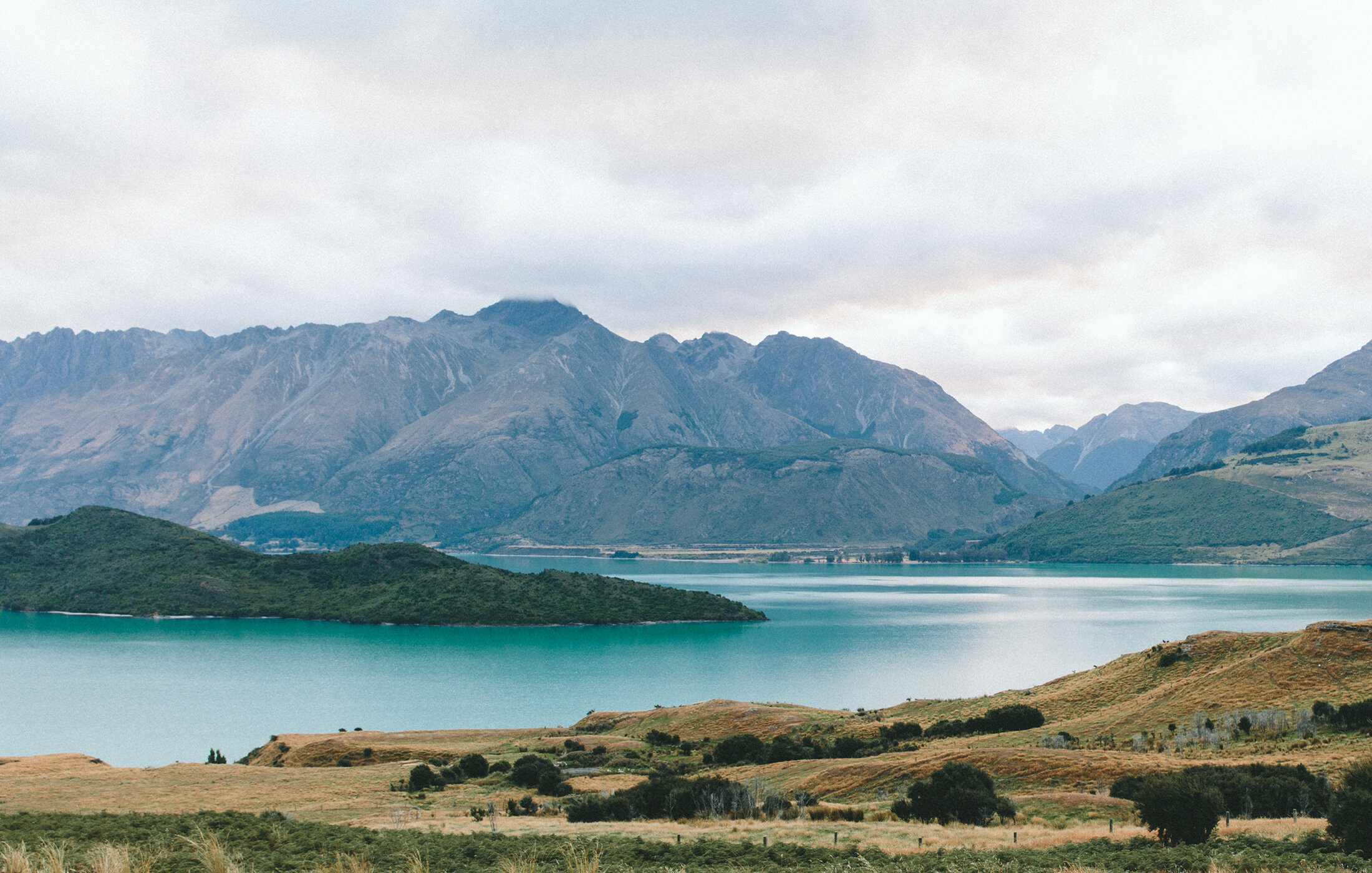
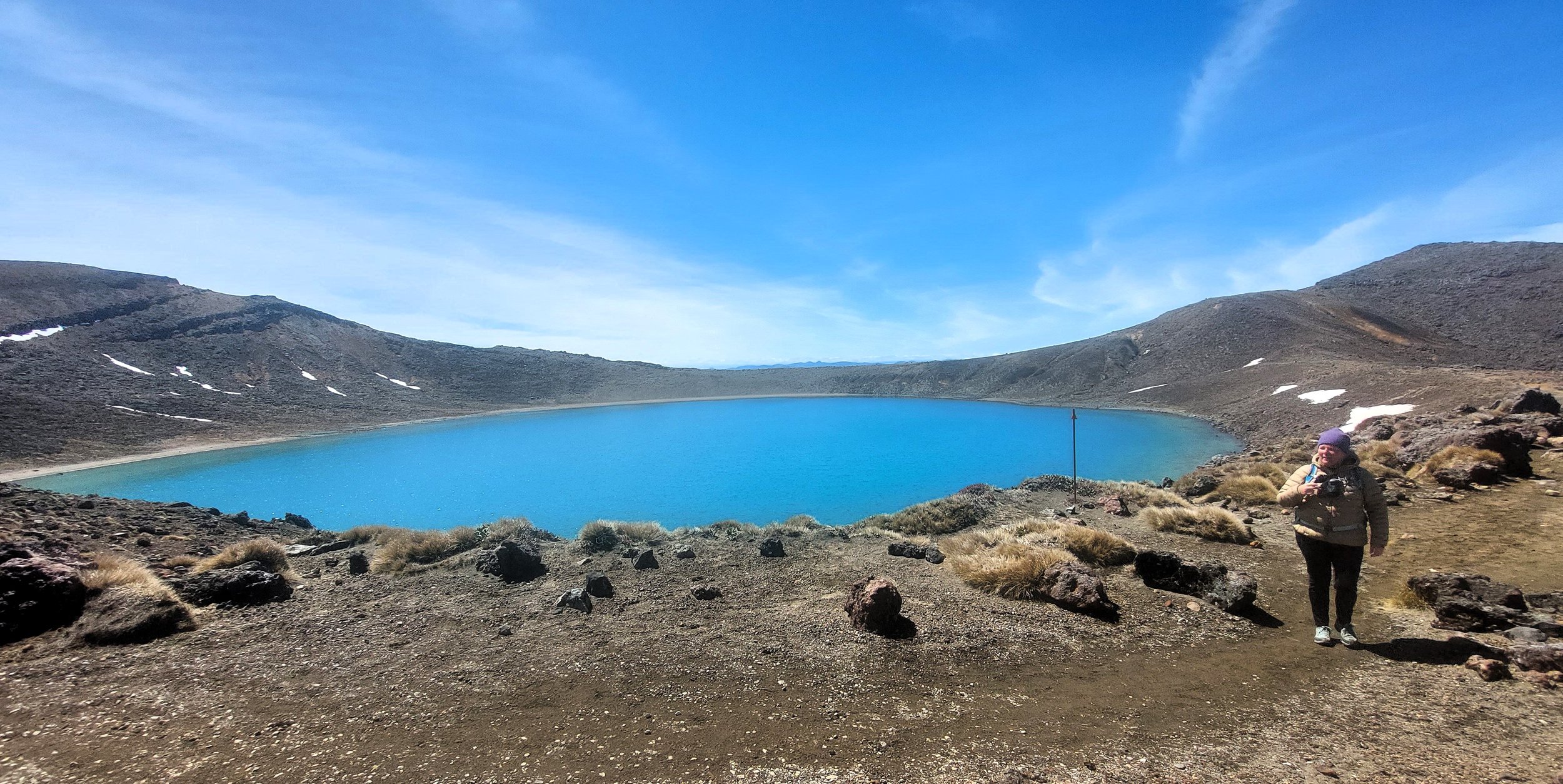
Because we had already been to Wellington before, we drove further north and finally made a stop in Taupo on Lake Taupo. On the route you can then drive the Desert Road where you have beautiful views of Mount Ruapehu and Mount Tongariro, weather permitting. The latter is of course known for the Tongariro Crossing, one of the most beautiful one-day walks there is. But more about that later.
The small town of Taupo is located on the shores of Lake Taupo with a small but quite cozy town center.
In nice and clear weather you have beautiful views across the lake and you can see the famous mountains Ruapehu, Ngauruhoe and Tongariro present themselves over a distance of 50 km to the south.
You can also visit the touristy Huka Falls from Taupo and there are a number of national parks and lakes in the area where you can do top hikes.
From Taupo, which is centrally located on the North Island, you can easily continue your journey in all directions.

From Taupo we continued north and drove straight to the region north of Auckland. In Orewa we stopped for lunch with Janice and Barry. Earlier in 2023 we looked after their dog Beau and it was nice to see that they were doing well and that Beau still recognized us.
A little further north we spent the night at Mangawhai Heads on the coast. The coast here is beautiful and we did the famous Mangawhai Cliff Walk which goes for miles along the beach and cliffs to the Natural Arch and back. From Mangawhai Heads we then drove to Russell in the Bay of Islands in 1 day. The weather was beautiful and we made stops in Whangarei at the local waterfall near the city and in Tutukaka on the coast. The last part of the scenic route along the coast between Whananaki and Russell was enchantingly beautiful. From here our pace slowed down as we went to places we hadn't been before, which was exactly the point of this tour.
We stayed in Russell for a few days to visit the Bay of Islands from there. The walk to Flagstaff Hill and Tapeka Point was especially beautiful.

Cape Reinga is the northwesternmost tip of the Aupouri Peninsula, at the northern end of New Zealand's North Island.
Cape Reinga is located more than 100 km north of the nearest town of Kaitaia. State Highway 1 extends all the way to the cape, but until 2010 the last 12 miles (19 km) was an unpaved dirt road.
Reinga is the Maori word for underworld. It refers to the Maori belief that the cape is the point where the spirits of the dead enter the underworld. Due to the bad weather and because almost everything was closed, our visit was limited to a quick sprint to the lighthouse to take some photos.
Bay of Islands
The Bay of Islands is an area on the east coast of the Far North District of the North Island of New Zealand.
The bay itself is a kind of natural harbor and contains 144 islands, most of them uninhabited. If, like us, you stay in Russell, you are still on the mainland, but actually in the middle of the bay because of it’s location.
Russell is therefore a perfect base to visit the Bay of Islands. Because it is still on the mainland, it can be reached by car, but then you have to take a bit of a (beautiful) detour, like we did. It is easier to take the ferry from Opua to Okiato, we did that on our further journey north.
The weather changed quite a bit as we left the Bay of Islands. We were on our way to the northernmost point of the North Island which is Cape Reinga. On the way to Cape Reinga we of course made a few nice stops. On a Saturday we stopped in the small town of Kerikeri and that happened to be the perfect day because on Saturdays there is a nice market in Kerikeri. In and around The Old Packhouse there is a farmers/artisan market with many local suppliers of all kinds of edible and non-edible stuff.
From Kerikeri we continued the scenic route along the coast to eventually arrive at Hihi Beach. There was a cute campsite there, but we were unable to enjoy it much due to rainy and stormy weather. It was the same weather the next day and that was the day we wanted to go to Cape Reinga. Despite the bad weather and knowing that camping sites were closed due to the bad weather, we decided to go anyway. It was a turbulent ride with a lot of rain and a lot of wind, but that is also part of the journey.

Because the weather was really bad for a few days, with the low point being the day we went to Cape Reinga, we stayed in Northland shorter than planned. After the drive to Cape Reinga, we landed in Ahipara on the west coast of Northland the same day. There was a very relaxed campsite with a super cozy lounge where it was nice and warm and dry after a day in the rain and wind. In Ahipara, most hikers who walk the Te Araroa arrive after about 3-4 days. That was no different on the day we were there, but most of them arrived as drowned cats. From Ahipara we continued our way along the west coast of Northland, heading south That is an area where not many people live and where fewer tourists come. After an hour's drive we took the ferry at Kohukohu. From there we visited the boulders at Koutu and the beautiful little town of Omapere.
Omapere
Omapere is a settlement on the south coast of Hokianga Harbor in Northland, New Zealand.
It is a rural settlement with an estimated population of 475. It’s location on the Hokianga Harbouw makes the town and surrounding area picturesque in all weather conditions.
Nearby are the Koutu Boulders, a stone formation on the banks of the Hokianga. From Omapere itself you walk to the scenic lookout where you have a great view of the ocean, the Hokianga Harbor and Orongotea Bay.
From Omapere the road continues south along the coast and through the Waipoua Kauri Forest. In this forest you will find the two largest Kauri trees. In addition, you can see glow worms in the evening and if you are lucky you can encounter kiwis, when you take a walk through the forest. On the way further south we took a walk along the desolate Baylys Beach and climbed the Tokatoka lookout. This rises like a steep pimple above the otherwise rather flat landscape and it is a short and steep climb, but certainly worth it.
Because we had visited many things on our wish list in the Nothland and Auckland regions, we decided to drive to the Coromandel in two days. That seems far, but in terms of distance it was not so bad. We made a stopover in Waipu north of Auckland and from there straight to Thames, which is located on the southwest side of the Coromandel Peninsula. During our first tour in New Zealand in early 2023, Coromandel was inaccessible due to the floods, but now it was much better. Actually, only the roads through the interior and the mountains were still closed. The road that takes you around the Peninsula was open. We ended up spending 4 days on the Coromandel, more than enough time for leisurely exploration.
Coromandel
The Coromandel on New Zealand's North Island extends 85 kilometers north from the western end of the Bay of Plenty, and is 40 kilometers wide.
Almost the entire population lives on the narrow coastal strips on the Hauraki Gulf and the Bay of Plenty. In clear weather, the peninsula is clearly visible from Auckland, the country's largest city, which lies across the Hauraki Gulf, 55 kilometers (34 miles) to the west.
You can drive around the peninsula via state highway 25, which is a beautiful drive with sometimes breathtakingly beautiful views. In the first months of 2023, the Coromandel was unfortunately hit by flooding due to a cyclone and heavy rain, so route 25A that crosses the peninsula was still closed when we were there.


From the Coromandel it is logical for many that are heading South to then head towards Rotorua. That is one of the areas with a lot of geyser activity and in Rotorua you can often smell the sulphur. But we had already been there in 2018 and found and still find it to be a rather touristy environment. Our goal was to travel east towards Eastcape and the east coast. Nevertheless, we made a small detour after the Coromandel towards the south and that was to visit the Blue Springs. These are located an hour south of the Coromandel and half an hour west of Rotorua, so the distance isn't too bad.
Blue Springs
The Blue Springs are a river and a pool that excel in beauty, not only because of the very clear water but also because of the magical green environment.
The Blue Springs is fed from the Mamaku Plateau and this water is old; it takes 100 years to filter through the plateau. At a rate of 42 cubic meters per minute it flows into the Waihou River and eventually flows into the sea at Thames.
Blue Spring water is so pure that it supplies 60 percent of New Zealand's bottled water. Swimming is no longer allowed, we think this is a good thing.
From the car park it is a beautiful 5km walk along the Waihou River to the pool and you can enjoy the beautiful scenery and some viewpoints along the way.