Pico de Malpaso

Pico de Malpaso
The Pico de Malpaso is the highest point on the island of El Hierro. The summit is 1501 meters high, making this highest point slightly higher then Alto de Garajonay on La Gomera. Because on the first visit the summit was covered in clouds and fog, we visited the Pico de Malpaso twice. Read in this blog about both visits and the beautiful view you have in clear weather.
Pico de Malpaso is located just southeast of the center of El Hierro on the vulcanic ridge. This ridge curves slightly from east to west across the island. On the east side of the ridge the Mirador de la Pena is the furthest point, on the west side it is Mirador de Bascos. This ridge is the natural partition of the valley on the north side of the island called El Golfo. Visiting the Pico de Malpaso is absolutely worth it, especially for the phenomenal views from the top.
This summit is easily accessible by car, you can actually just drive to the summit. From the HI-45 there is a partly unpaved road of about one kilometer that leads up to the summit. The car can be parked well there. The HI-45 is a connecting road between the major roads HI-1 from the junction at La Llania and the HI-400 on the southwest side towards Punta de la Orchilla. But of course it is much more fun to hike to the summit. The Pico de Malpaso is along the GR-131 trail that runs from Tamaduste on the coast in the east to the Faro de Orchilla on the coast in the west. This route is 37.7 km long in its entirety with a height difference of 1501m, up and down. From the hiking scene it is recommended to do this trail in two stages.

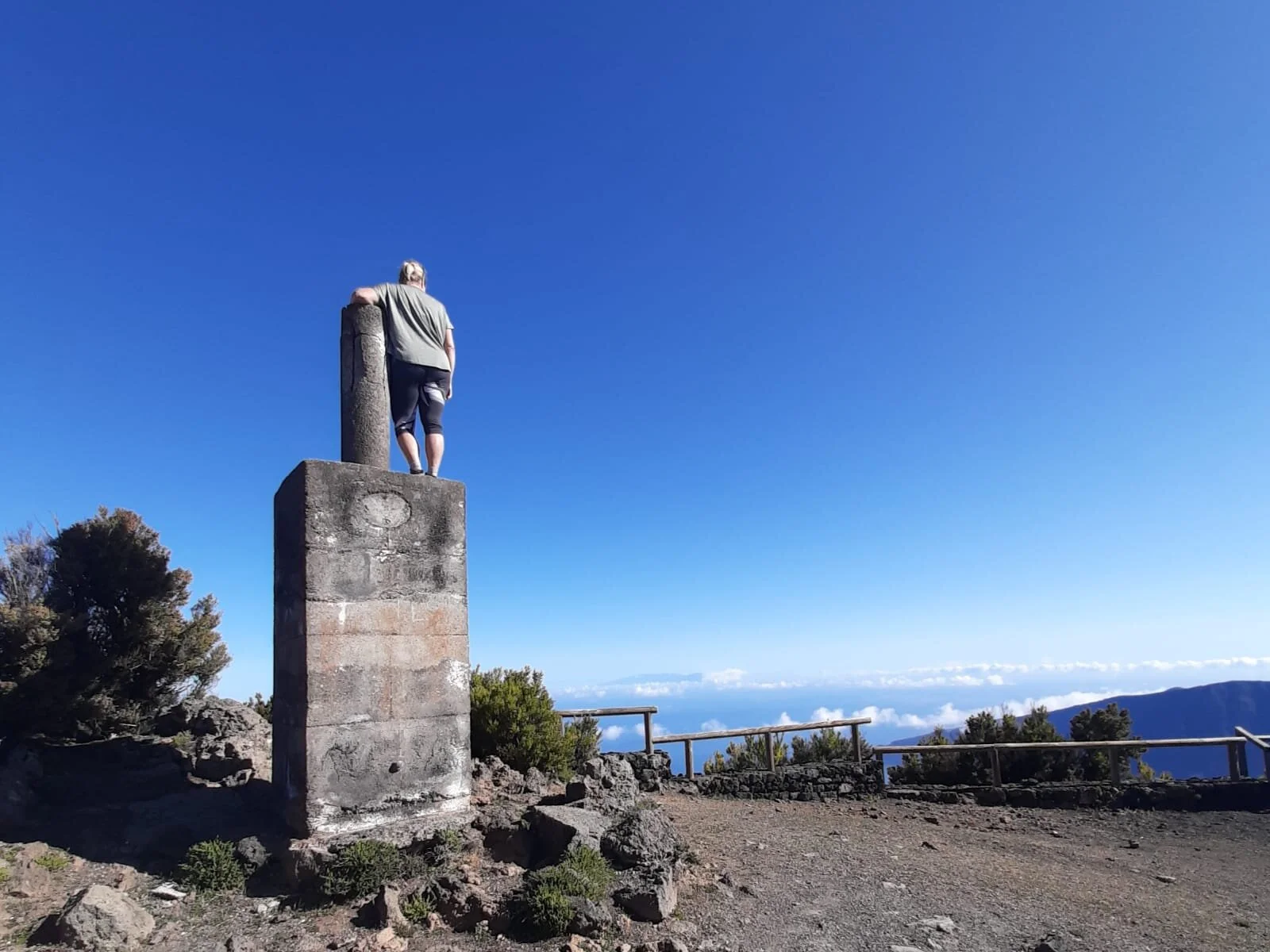
Pico de Malpaso
The summit at Pico de Malpaso in clear skies at 1501m
We chose to walk a part of the GR-131 trail so that we had time to enjoy the trail and all the beautiful things you see around you. We decided to park the car at the parking area of La Llania. We had been there before for an earlier hike so we knew this would be a convenient choice. From there it is about 5km along the GR-131 to the Pico de Malpaso with almost 200 vertical meters to overcome. That is really not very difficult and easy to do. The first kilometer is even partly along the paved road, but there is not much to it. From Dos Hermanas however, the trail goes its own way through the vulcanic landscape and through the forests and then it becomes really beautiful. Dos Hermanas is also a take off point for paragliders, and especially read the blog about the paraglide flight that Geert made and when he took off from there soon.
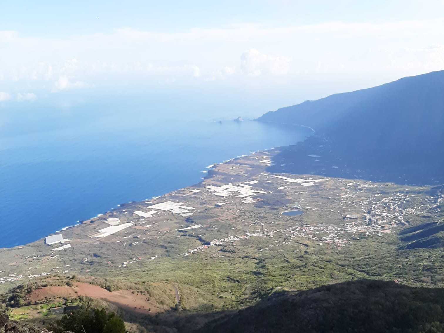
El Golfo views
When the skies are clear you have great views of El Golfo from Pico de Malpaso
When we passed Dos Hermanas the sky was still as good as clear and we saw the summit in the distance. We even left early on purpose because we knew we would run the risk of increasing clouds and fog. From Dos Hermanas you have fantastic views over the El Golfo valley and the Atlantic Ocean in the distance. In clear weather you can see all the way from the Roques de Salmor in the sea in the east to Arenas Blancas in the west. Once you have passed Dos Hermanas you can also see the Atlantic Ocean on the south side and the landscape of El Julan along the south coast of the island. You actually walk over the ridge and through the vulcanic landscape with alternating great views of the island and the ocean on both sides. On the way you will pass Cruz de los Reyes, an important place on the island. It is a pitch at an altitude of 1400m where there is a big cross and where communal food is prepared during the Bajada de la Virgen. The Bajada de la Virgen is a festival held every 4 years in honor of the image of the Virgen de los Reyes.

Cruz de los Reyes
The Cruz de los Reyes at 1400m is an important place for the islanders during the Barjada de la Virgen
As mentioned, the climb to Pico de Malpaso is not difficult, only the last part is a bit tough, but easy to do for any somewhat experienced hiker. When we got closer to the top we already saw that the clouds and fog were increasing rapidly. And once at the summit we actually didn't see much anymore, and it even became chilly. Now and then there was a small hole in the cloud cover and we could see the valley. Because the weather was nice for hiking, we hiked a bit further along the GR-131 towards the west. From Malpaso you then have more and more visibility on the south side. At some point we turned around and hiked back. But if you follow the GR-131 further to the west you will eventually reach the La Dehesa area. Here you can also hike beautiful other trails that take you to El Sabinar, the church Virgen de los Reyes and the Mirador de Bascos.

Rising clouds
Rising clouds seen from Pico de Malpaso with La Palma in the background
Of course we did not give up and when we saw two days later at sunrise that the weather was clear, we actually drove straight up and hiked towards the summit again. The sooner you get there, the smaller the chance of cloud cover. Because we had already looked around a lot on our first visit, we hiked to the summit in one go the second time and that was a good choice. Upstairs it was still almost clear and we had great views. When it is really clear, if you look northwest, you can catch three other islands at a glance. The silhouettes of La Palma, La Gomera and Tenerife loom on the horizon. And because you are on El Hierro you can take pictures where 4 islands are in 1 picture. On the first visit we had hardly any view of the El Golfo valley, but that was different now. Almost every detail was clearly recognizable from the Pico de Malpaso, it was even possible to recognize our accommodation near the coast. After we had absorbed everything well, it was time to eat the breakfast we brought with us in the sun. In the distance we saw the first paragliders leave from Dos Hermanas.
Clear skies
When the skies are clear the views at Pico de Malpaso are fantastic
While we were having breakfast, the clouds started to increase again, but now that was actually in our favor. This allowed us to observe the spectacle of drifting clouds and fog and take some beautiful pictures of it. By visiting the Pico de Malpaso we have also conquered the three highest points of the islands of La Gomera, La Palma and El Hierro. When you are on one of the islands, we recommend that you do that, preferably go hiking. And what applies to Pico de Malpaso, actually also applies to the Alto de Garajonay on La Gomera and Roque de los Muchachos on La Palma. Go as early as possible because then the chance of cloudiness is smallest and the light of the morning sun is really the best.
For more photos and information about Pico de Malpaso, check out our Instagram posts and our Polarsteps page!
Ella & Geert.